• chevron_right

      ‘Everybody has a breaking point’: how the climate crisis affects our brains

      news.movim.eu / TheGuardian · Wednesday, 27 March - 05:00 · 1 minute

    Are growing rates of anxiety, depression, ADHD, PTSD, Alzheimer’s and motor neurone disease related to rising temperatures and other extreme environmental changes?

    In late October 2012, a category 3 hurricane howled into New York City with a force that would etch its name into the annals of history . Superstorm Sandy transformed the city, inflicting more than $60bn in damage, killing dozens, and forcing 6,500 patients to be evacuated from hospitals and nursing homes. Yet in the case of one cognitive neuroscientist, the storm presented, darkly, an opportunity.

    Yoko Nomura had found herself at the centre of a natural experiment. Prior to the hurricane’s unexpected visit, Nomura – who teaches in the psychology department at Queens College, CUNY, as well as in the psychiatry department of the Icahn School of Medicine at Mount Sinai – had meticulously assembled a research cohort of hundreds of expectant New York mothers. Her investigation, the Stress in Pregnancy study , had aimed since 2009 to explore the potential imprint of prenatal stress on the unborn. Drawing on the evolving field of epigenetics, Nomura had sought to understand the ways in which environmental stressors could spur changes in gene expression, the likes of which were already known to influence the risk of specific childhood neurobehavioural outcomes such as autism, schizophrenia and attention deficit hyperactivity disorder (ADHD).

    Continue reading...
    • chevron_right

      Hurricane Larry dumped 100,000 microplastics per sq. meter on Newfoundland each day

      news.movim.eu / ArsTechnica · Tuesday, 19 December - 14:35 · 1 minute

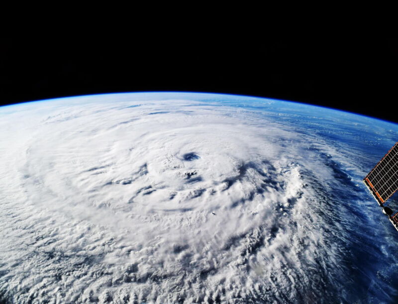
    Hurricane Larry dumped 100,000 microplastics per sq. meter on Newfoundland each day

    Enlarge (credit: J Marshall/NASA/ESA/T. Pesquet/Alamy)

    As Hurricane Larry curved north in the Atlantic in 2021, sparing the eastern seaboard of the United States, a special instrument was waiting for it on the coast of Newfoundland. Because hurricanes feed on warm ocean water, scientists wondered whether such a storm could pick up microplastics from the sea surface and deposit them when it made landfall. Larry was literally a perfect storm: Because it hadn’t touched land before reaching the island, anything it dropped would have been scavenged from the water or air, as opposed to, say, a highly populated city, where you’d expect to find lots of microplastics .

    As Larry passed over Newfoundland, the instrument gobbled up what fell from the sky. That included rain, of course, but also gobs of microplastics, defined as bits smaller than 5 millimeters, or about the width of a pencil eraser. At its peak, Larry was depositing over 100,000 microplastics per square meter of land per day, the researchers found in a recent paper published in the journal Communications Earth and Environment . Add hurricanes, then, to the growing list of ways that tiny plastic particles are not only infiltrating every corner of the environment, but readily moving between land, sea, and air.

    As humanity churns out exponentially more plastic in general, so does the environment get contaminated with exponentially more microplastics . The predominant thinking used to be that microplastics would flush into the ocean and stay there: Washing synthetic clothing like polyester, for instance, releases millions of microfibers per load of laundry, which then flow out to sea in wastewater. But recent research has found that the seas are in fact burping the particles into the atmosphere to blow back onto land, both when waves break and when bubbles rise to the surface, flinging microplastics into sea breezes.

    Read 10 remaining paragraphs | Comments

    • chevron_right

      AI outperforms conventional weather forecasting for the first time: Google study

      news.movim.eu / ArsTechnica · Tuesday, 14 November - 19:53

    A file photo of Tropical storm Fiona as seen in a satellite image from 2022.

    Enlarge / A file photo of Tropical Storm Fiona as seen in a satellite image from 2022. (credit: Getty Images )

    On Tuesday, the peer-reviewed journal Science published a study that shows how an AI meteorology model from Google DeepMind called GraphCast has significantly outperformed conventional weather forecasting methods in predicting global weather conditions up to 10 days in advance. The achievement suggests that future weather forecasting may become far more accurate, reports The Washington Post and Financial Times .

    In the study, GraphCast demonstrated superior performance over the world's leading conventional system, operated by the European Centre for Medium-range Weather Forecasts (ECMWF). In a comprehensive evaluation, GraphCast outperformed ECMWF's system in 90 percent of 1,380 metrics, including temperature, pressure, wind speed and direction, and humidity at various atmospheric levels.

    And GraphCast does all this quickly: "It predicts hundreds of weather variables, over 10 days at 0.25° resolution globally, in under one minute," write the authors in the paper "Learning skillful medium-range global weather forecasting."

    Read 6 remaining paragraphs | Comments

    • chevron_right

      Trying to make sense of why Otis exploded en route to Acapulco this week

      news.movim.eu / ArsTechnica · Thursday, 26 October - 15:17 · 1 minute

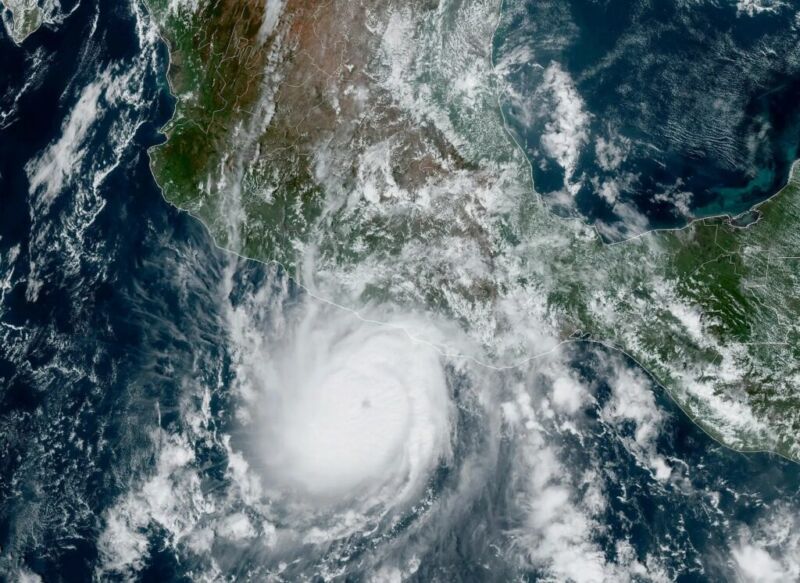
    Hurricane Otis on Tuesday, as it was strengthening before making landfall in Mexico.

    Enlarge / Hurricane Otis on Tuesday, as it was strengthening before making landfall in Mexico. (credit: NOAA)

    The word "unprecedented" gets tossed around a lot these days, but what happened with Hurricane Otis and its impact on Acapulco on Tuesday were truly without precedent. And it was with only slight precedent anywhere in terms of how quickly it intensified.

    Otis was the textbook definition of rapid intensification, going from a 50 mph tropical storm on Monday evening to a 165 mph category 5 hurricane last night. Through about mid-morning on Tuesday, everything was going basically as you'd expect for a modest hurricane with Otis. It may have been tracking toward a category 2 type landfall, or even a category 3 type landfall in the worst case, if you assumed the general rules of rapid intensification in this region. But Otis did not follow the rules.

    Much like an onion, there are layers to this story that are important. First, take it from one of the more seasoned NOAA hurricane hunters—this was not what they expected when they flew their mission on Tuesday. Meteorologist Jeremy DeHart wrote on the site formerly known as Twitter, "I have arrived to a storm & been surprised by the intensity, but nothing like this. Expected a marginal hurricane, found a Cat 3! Reminiscent of the stories I've heard about flying into Patricia ('05), in the same part of the world."

    Read 17 remaining paragraphs | Comments

    • chevron_right

      At least 27 dead after Hurricane Otis smashes into Mexico’s Pacific coast

      news.movim.eu / TheGuardian · Thursday, 26 October - 15:01

    The resort city of Acapulco was devastated by the category 5 hurricane, with hundreds of windows blown out and electricity cut

    At least 27 people died due to Hurricane Otis and four others were still missing, Mexico’s government said after one of the most powerful storms to hit the country smashed into the Pacific resort city of Acapulco a day before.

    President Andrés Manuel López Obrador said the government was working to re-establish power and clean up the devastation wrought by the category 5 hurricane that tore through the southern state of Guerrero, and left Acapulco incommunicado.

    Continue reading...
    • chevron_right

      AI is getting better at hurricane forecasting

      news.movim.eu / ArsTechnica · Thursday, 28 September, 2023 - 13:50 · 1 minute

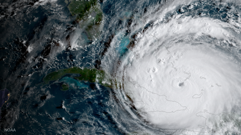
    Hurricane Irma as seen by satellite in 2019.

    Enlarge / Hurricane Irma as seen by satellite in 2019. (credit: NOAA )

    Hurricane Lee wasn’t bothering anyone in early September, churning far out at sea somewhere between Africa and North America. A wall of high pressure stood in its westward path, poised to deflect the storm away from Florida and in a grand arc northeast. Heading where, exactly? It was 10 days out from the earliest possible landfall—eons in weather forecasting—but meteorologists at the European Centre for Medium-Range Weather Forecasts, or ECMWF, were watching closely. The tiniest uncertainties could make the difference between a rainy day in Scotland or serious trouble for the US Northeast.

    Typically, weather forecasters would rely on models of atmospheric physics to make that call. This time, they had another tool: a new generation of AI-based weather models developed by chipmaker Nvidia, Chinese tech giant Huawei , and Google’s AI unit DeepMind. For Lee, the three tech-company models predicted a path that would strike somewhere between Rhode Island and Nova Scotia—forecasts that generally agreed with the official physics-based outlook. Land-ho, somewhere. The devil, of course, was in the details.

    Weather forecasters describe the arrival of AI models with language that seems out of place in their forward-looking profession: “Sudden.” “Unexpected.” “It seemed to just come out of nowhere,” says Mark DeMaria, an atmospheric scientist at Colorado State University who recently retired from leading a division of the US National Hurricane Center. When he started a project this year with the US National Oceanographic and Atmospheric Administration to validate Nvidia’s FourCastNet model against real-time storm data, he was a “skeptic” of the new models, he says. “I thought there was no chance that it could work.”

    Read 13 remaining paragraphs | Comments

    • chevron_right

      Tropical Storm Ophelia makes landfall in North Carolina as it moves up east coast

      news.movim.eu / TheGuardian · Saturday, 23 September, 2023 - 13:37

    Governors of Virginia, North Carolina and Maryland declare states of emergency as storm expected to bring heavy rainfall

    Tropical Storm Ophelia made landfall on the coast of North Carolina near Emerald Isle early on Saturday as the storm moved north along the US east coast.

    Before the storm’s landfall, the governors of Virginia, North Carolina and Maryland declared states of emergency. Ophelia was predicted to bring heavy rainfall, tropical storm force winds and minor flooding along the states’ coasts through the weekend.

    Continue reading...
    • chevron_right

      Hurricane Idalia leaves trail of floods and wreckage in south-eastern US

      news.movim.eu / TheGuardian · Thursday, 31 August, 2023 - 12:38

    Tropical storm moves into Atlantic but torrential rain and inland flooding still likely in North Carolina, officials warn

    Recovery efforts were under way in four states on Thursday as the remains of Hurricane Idalia, still a tropical storm with 60mph winds, moved into the Atlantic off the coast of the Carolinas.

    Crews were sifting through wreckage across North and South Carolina, Georgia and Florida, where the storm came ashore on Wednesday as a category 3 hurricane with gusts of 160mph and sent a surge of seawater up to 16ft high inland through vulnerable coastal areas.

    Continue reading...
    • chevron_right

      After slow start, NOAA predicts rest of hurricane season to be “above normal”

      news.movim.eu / ArsTechnica · Friday, 11 August, 2023 - 14:36 · 1 minute

    aerial view of hurricane damage

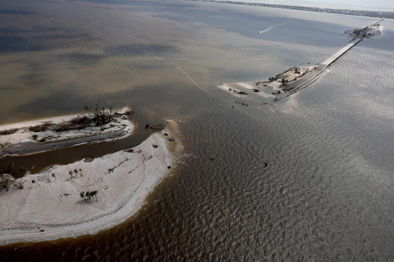
    Enlarge / In Florida, parts of the Sanibel Causeway to Sanibel Island are washed away, along with sections of the bridge to the island, after Hurricane Ian passed through the area in September 2022. The hurricane brought high winds, storm surge and rain to the area causing severe damage (credit: Joe Raedle/Getty Images)

    NOAA forecasters are upping their expectations for the 2023 hurricane season, based on record-warm Atlantic sea surface temperatures.

    The National Oceanic and Atmospheric Administration announced Thursday that forecasters have increased the likelihood of an above-normal season to 60 percent. The forecasters now expect 14 to 21 named storms, including six to 11 hurricanes and two to five major hurricanes of category 3, 4, or 5 strength, packing sustained winds of 111 miles an hour or more.

    In May the forecasters at NOAA’s Climate Prediction Center had projected a 30 percent chance of an above-normal season and thought a near-normal season was more likely, with 12 to 17 named storms. They said Thursday the revised forecast, issued routinely in August near the heart of the season, was based on Atlantic sea surface temperatures that have not been seen since record-keeping began in 1950, said Matthew Rosencrans, lead hurricane season forecaster at the Climate Prediction Center, a division of the National Weather Service.

    Read 10 remaining paragraphs | Comments